China Focus: China launches satellite to enhance survey, mapping service capabilities

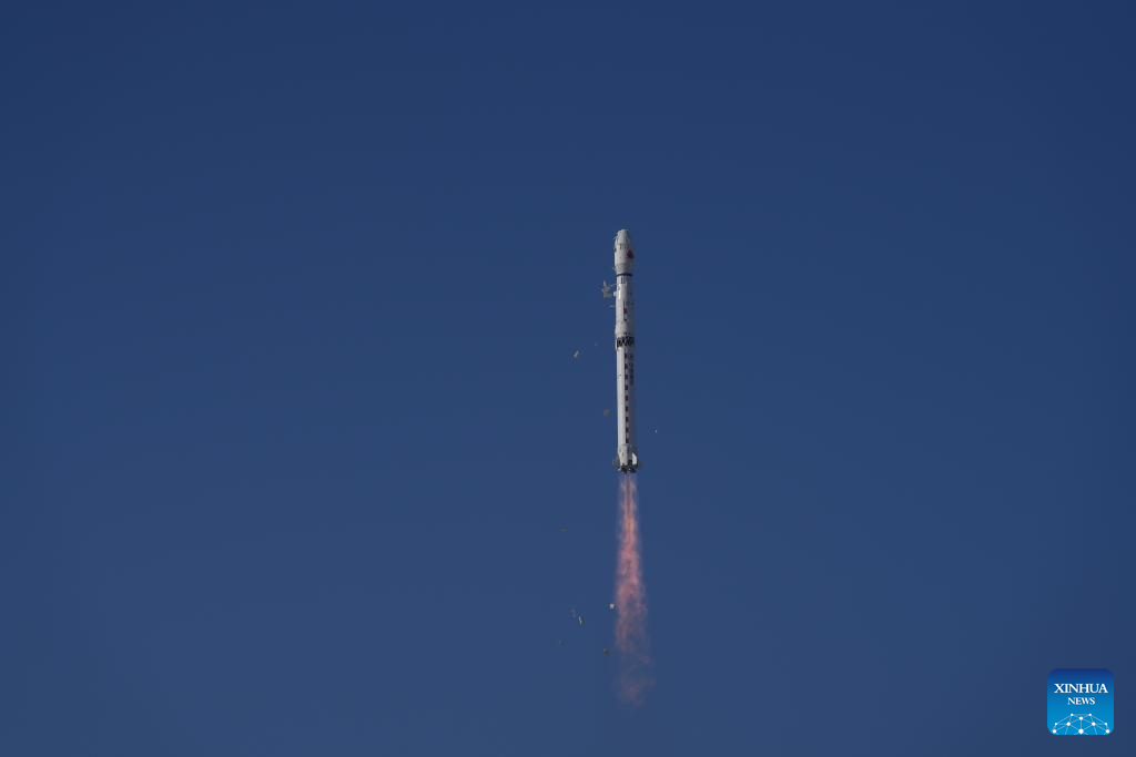
A Long March-4B rocket carrying Ziyuan III 04 satellite blasts off from the Taiyuan Satellite Launch Center in north China's Shanxi Province, on Dec. 16, 2025. The satellite was launched at 11:17 a.m. Beijing time. (Photo by Wang Yapeng/Xinhua)
TAIYUAN, Dec. 16 (Xinhua) -- China on Tuesday sent a new satellite into space from the Taiyuan Satellite Launch Center in the northern province of Shanxi, in a move to enhance the country's survey and mapping service capabilities.
The Ziyuan III 04 satellite was launched by a Long March-4B rocket at 11:17 a.m. Beijing Time, according to the center.
It was the 617th flight mission of the Long March rocket series.
Major payloads of the Ziyuan III 04 satellite include a three-line array camera, a multispectral camera and a laser altimeter, according to China Academy of Space Technology, which is under the China Aerospace Science and Technology Corporation.
According to the satellite's developer, these cameras will enhance China's capabilities in obtaining spatial geographic information, and improve survey and mapping services.
The three-line array camera acts as a "stereoscopic photographer." It is composed of three cameras with different shooting angles, which can generate three-dimensional images of observed objects through aerial triangulation observation.
The multispectral camera is like a "fingerprint collector" for the spectral characteristics of different elements and their compounds on Earth, which are important "ID cards" used in remote sensing science to identify and analyze the features of various objects. Its main task is to collect the spectral characteristics of the observed objects.
By analyzing these spectral "fingerprints," experts can determine the physical characteristics of various objects, and analyze specific conditions such as farmland yield, vegetation quantity and water pollution degree.
The laser altimeter is comparable to a "space ruler," capable of achieving sub-meter measurement accuracy at a distance of approximately 506 kilometers, serving as a reference for elevation correction in stereoscopic mapping.
The Ziyuan III 04 satellite will replace the retired Ziyuan III 01 satellite. Then, a high-resolution stereo mapping satellite constellation will be formed by the new satellite and the Ziyuan III 02 and 03 satellites, both of which are already in orbit.
According to its developer, the new satellite constellation can increase the acquisition capacity of basic land-resource survey and mapping data by 1.5 times.
It will effectively meet the time-efficiency requirements of survey and mapping tasks, and continuously provide stable, reliable data support for the country's survey, mapping and geographic information industry, the developer said.
As of December 2025, the Ziyuan-III-series satellites have obtained a total of 4.03 million valid image data sets, with an effective global coverage area of 137 million square kilometers.
They have effectively sustained progress in the geographic information industry, with related survey and mapping geographic information products serving fields such as land resources, environmental protection and disaster monitoring. ■
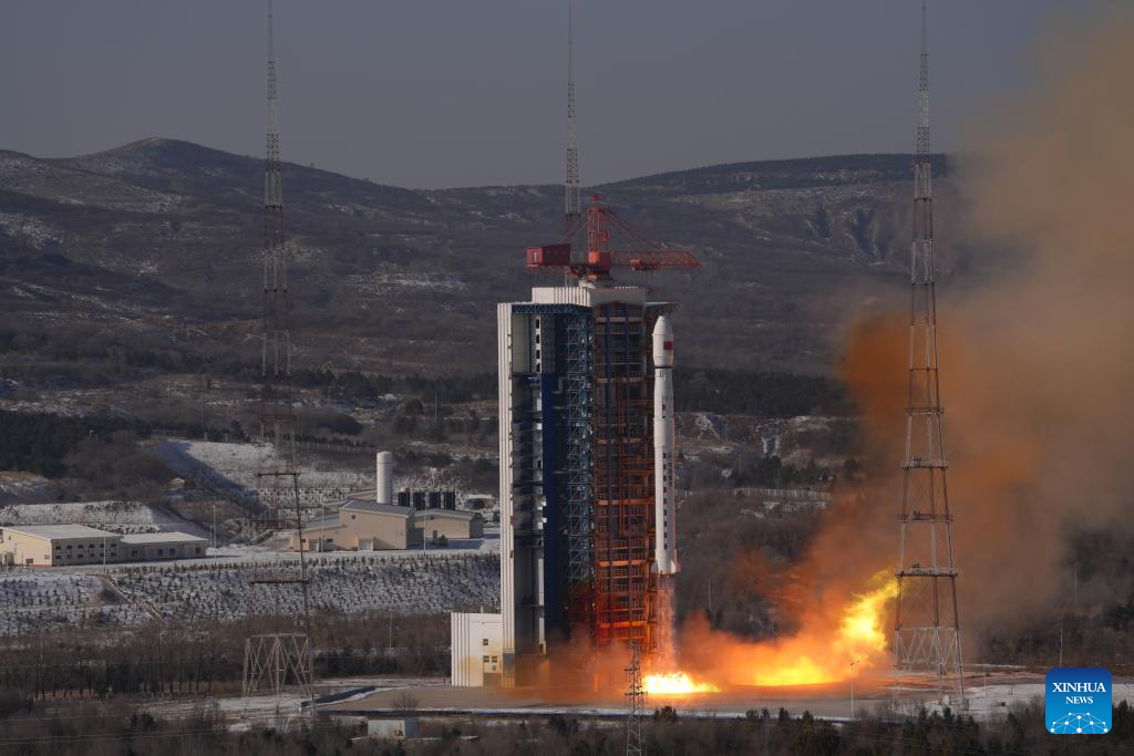
A Long March-4B rocket carrying Ziyuan III 04 satellite blasts off from the Taiyuan Satellite Launch Center in north China's Shanxi Province, on Dec. 16, 2025. The satellite was launched at 11:17 a.m. Beijing time. (Photo by Wang Yapeng/Xinhua)
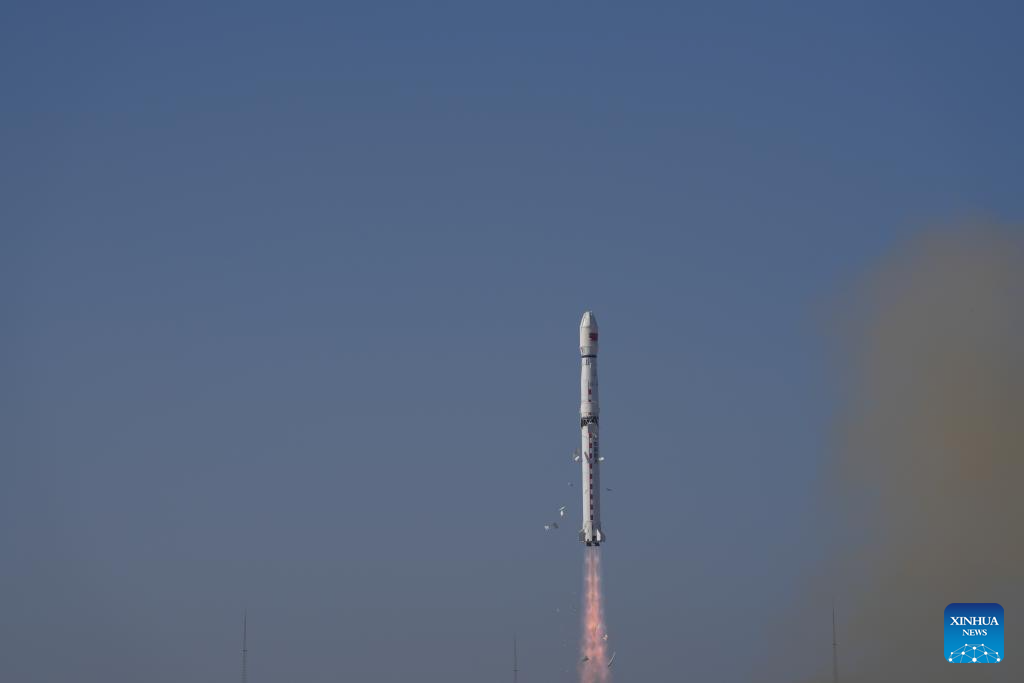
A Long March-4B rocket carrying Ziyuan III 04 satellite blasts off from the Taiyuan Satellite Launch Center in north China's Shanxi Province, on Dec. 16, 2025. The satellite was launched at 11:17 a.m. Beijing time. (Photo by Wang Yapeng/Xinhua)
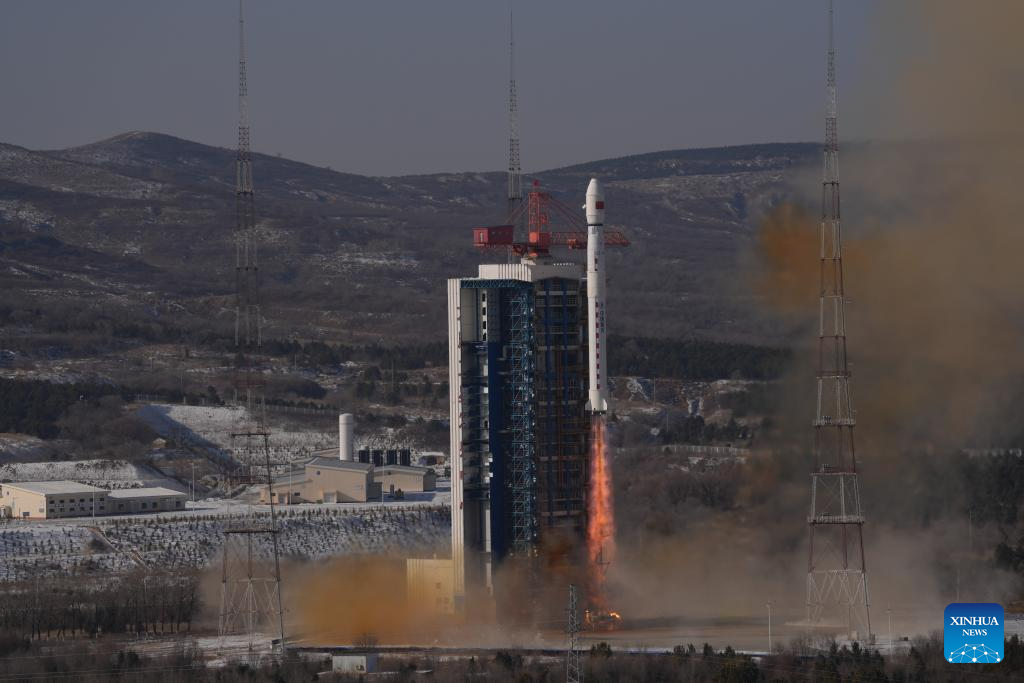
A Long March-4B rocket carrying Ziyuan III 04 satellite blasts off from the Taiyuan Satellite Launch Center in north China's Shanxi Province, on Dec. 16, 2025. The satellite was launched at 11:17 a.m. Beijing time. (Photo by Wang Yapeng/Xinhua)


